
Italy 2001
Herculaneum
|
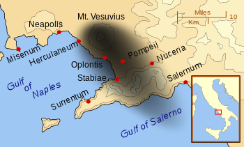 |
| As can be seen from the map, Herculaneum was on the periphery of the ash cloud emitted by Mount Vesuvius in 79 AD. This resulted in many of the multi-storied homes to not collapse, as they did in Pompeii, that was buried under a much thicker and heavier ash layer. The site of Herculaneum was settled in the 6th Cent BC by Samnite tribes and later became Greek and was named Heraklion. After changing hands again, it became Roman in 89 BC. |
Herculaneum, like Pompeii, was in the path of pyroclastic flow. That is a superheated avalanche of hot ash that can move at speeds of 60 mph (100 kmph) and reach temperatires of 500 degrees Celsius. Herculaneum was rediscovered in the 1700s and tunnels were driven into the fused layers of ash, to strip it of any saleable valuables. A more scientfic approach was later attempted, but not until the 20th Century was a small section of Herculaneum excavated by modern means and explored. Now you know why modern scientists like to keep parts of archaological sites in their original, unexcavated state, to permit future scientists to explore the site with more modern scientific tools. A very nice account of the history of the excavation can be read here. |
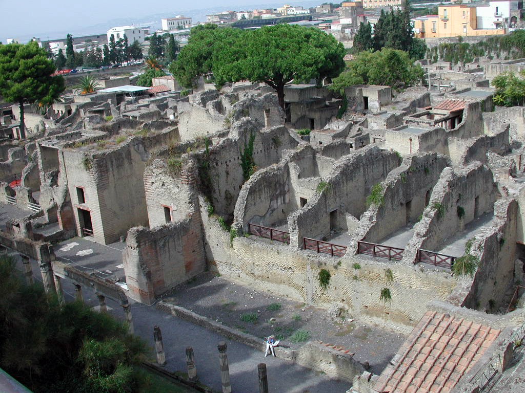 |
Lying well below current ground level, makes it easily surveyable. I like its compactness, too. |
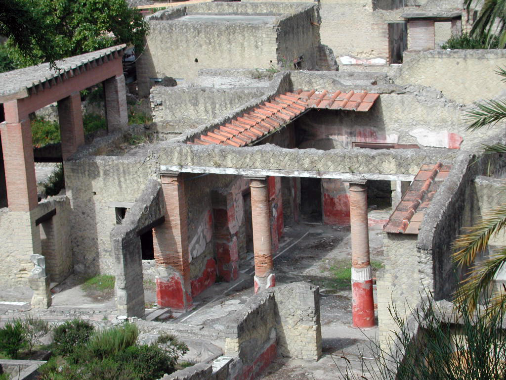 |
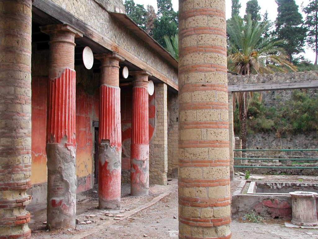
Herculaneum was clearly a prosperous city, to judge from the elaborately decorated houses and public places |
 |
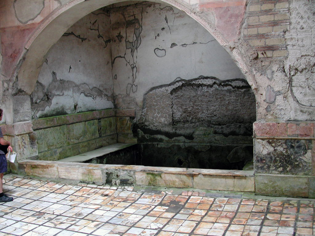 |
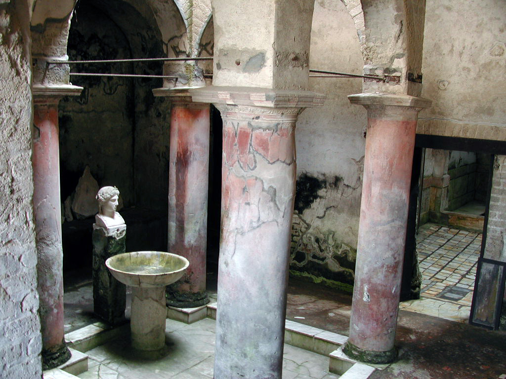
Inside an excellently preserved Roman bath house |
 |
Murals and paint schemes abound in this sea-side community (300 skeletons were found in the harbor area) |
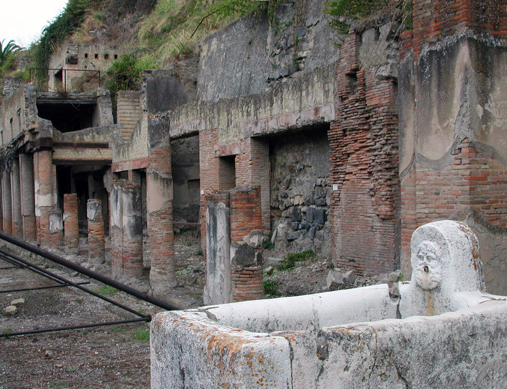 |
A public water supply source - not everyone had water piped into their houses |
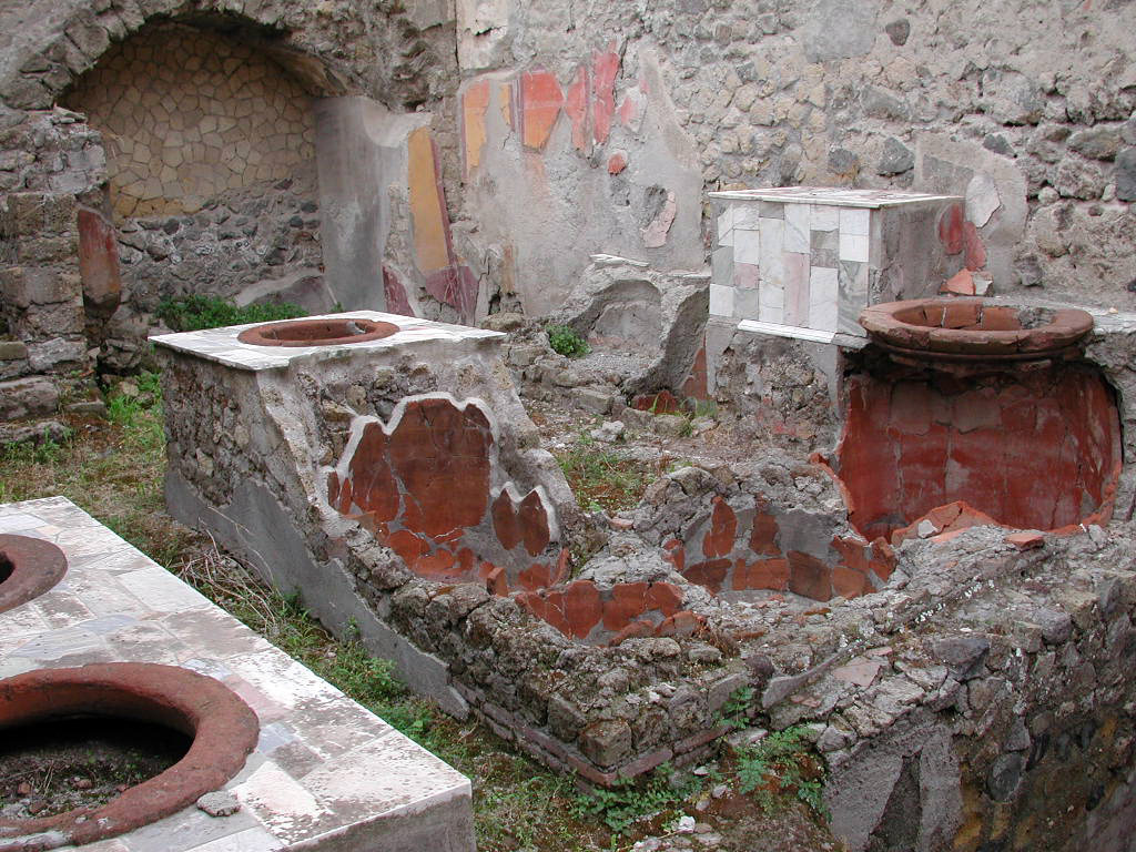 |
What used to be a restaurant kitchen |